 |
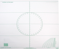
These sheets are a great time saver for three purposes. When crossing an ocean it is impractical to work out your dead reckoning position and your celestial navigation position and reconcile them on the small scale of an ocean chart. These sheets allow you to choose the appropriate longitude spacings for any latitude so that you are in effect creating a little chart for the particular bit of ocean that you are on at the moment, and can work out everything at a convenient scale. Probably you’ll mark your final position on an ocean chart so you can visually see your progress, but otherwise you don’t need to fool with the ocean chart at all. A second use comes into play if you need to enter a strange harbor or other confined area for which you don’t have a chart on board. If you consult the pilots, light lists, and other information you probably have on board, you very often can construct quite a detailed chart. Further you will have visual reminders of what you know and don’t know so you will be aware of where unknown dangers may lie and therefore can make decisions about what areas to avoid and which ones to favor. The third use which I find a lot of fun is to aid in constructing sketch charts of favorite harbors and tight little places which are often so charming yet are not shown in sufficient detail on the regular charts. These may be constructed from hand held GPS readings, soundings, and bearings etc. just to get into a harbor for a one time visit. However it is also fun and compelling to really make a project out of it and construct a truly detailed and accurate chart that you can contemplate bundling with others to make a nice little cruising guide for those following in your wake. Some have made quite a career of this yet some of the most beautiful cruising grounds in the world have never had a guide done which incorporates plenty of detailed carefully done sketch charts. To make sure the charts you construct from your plotting sheet have the maximum readability for sailors from all over the world use the standard symbols, terms, and abbreviations from “Chart No. 1” which is also reviewed on this site. A neat trick which used to be used on charts all the time, but which have gradually been eliminated from government charts for some reason, is to mark a point on the approach to the harbor on the chart and do a drawing of what the entrance will look like from that point. This can be anything from pretty drawing showing trees, houses, docks, etc to a silhouette of the land formations. Of course these days many will prefer to include photographs showing the same information. If you really get into this it is also possible to carry small remote control model aircraft with cameras on board to take aerial photos as well. All this depends upon the plotting sheet to bring the information together and create the perfect little chart. It is work mentioning that there are instructions in Bowditch, “The American Practical Navigator”, on creating your own plotting sheets. Frankly these pads of plotting sheets are so inexpensive that it makes much more sense to just buy them, except in one circumstance. Those of us who use the CAD program Rhino will find that it is fully equipped to do cartography and you can recreate your plotting sheet in your computer and call up new versions of it to record each new sketch chart. Since these can be directly transferred for publishing or can be sent to people you know who may follow in your wake as pdf files, this can be a great option. In this case I would do all the recording of information on the physical plotting sheet and then transfer everything into the computer to create the final sketch chart. This is especially convenient in that you can create a library of the Chart No. 1 symbols and abbreviations and import them into your chart as needed. No matter how simply you use these plotting sheets or how far you take the chart making, this pad of plotting sheets is the basis for it all. (tm) ($7.95, 50 sheets, printed on both sides) |